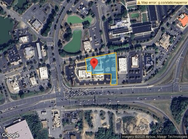
Property Record
2931 Plank Rd, Fredericksburg, VA 22401


NEARBY LISTINGS FOR SALE OR LEASE
Property Detail
2931 Plank Rd
7769-62-7720
55,774 SQ FT BL 291-1-2931
Commercialnec
Fredericksburg
X
Virginia
51179C0195F
1.28 AC
2025
Fredericksburg City
2025
Washington, DC
000500
Washington-Arlington-Alexandria, DC-VA-MD-WV
5,296 SF
DEMOGRAPHICS near 2931 Plank Rd
1 Mile
3 Mile
5 Mile
2024 Total Population
4,977
57,214
137,016
2029 Population
5,442
62,201
150,602
Pop Growth 2024-2029
+ 9.34%
+ 8.72%
+ 9.92%
Average Age
38
38
38
2024 Total Households
1,803
22,295
50,395
HH Growth 2024-2029
+ 9.54%
+ 8.92%
+ 9.99%
Median Household Inc
$93,645
$78,265
$93,713
Avg Household Size
2.70
2.40
2.60
2024 Avg HH Vehicles
2.00
2.00
2.00
Median Home Value
$359,190
$354,414
$351,353
Median Year Built
2002
1989
1993
Nearby Places
- Restaurants
- Banks
- Shops
- Fitness
- Groceries
PUBLIC TRANSPORTATION
COMMUTER RAIL
Fredericksburg (Fredericksburg Line - Virginia Railway Express)
DRIVE
WALK
Distance
Fredericksburg (Fredericksburg Line - Virginia Railway Express)
9 min
3.7 mi
Leeland Road (Fredericksburg Line - Virginia Railway Express)
DRIVE
WALK
Distance
Leeland Road (Fredericksburg Line - Virginia Railway Express)
16 min
7.9 mi
Freight Ports
Virginia Port Authority - Richmond
DRIVE
WALK
Distance
Virginia Port Authority - Richmond
75 min
62.5 mi
SALE & LEASE HISTORY
LISTING DATE
SALE/LEASE

Apr 19, 2023
For Lease
Nearby Properties
Address
Land Use
TOTAL SIZE
Lot Size
Zoning
Address
Land Use
TOTAL SIZE
Lot Size
Zoning
945,573 SF
22.10 AC
PDMC
Address
Land Use
TOTAL SIZE
Lot Size
Zoning
920,303 SF
105.86 AC
MZ - MULTI
Address
Land Use
TOTAL SIZE
Lot Size
Zoning
427,478 SF
15.36 AC
PDC
Address
Land Use
TOTAL SIZE
Lot Size
Zoning
14,500 SF
CT
Address
Land Use
TOTAL SIZE
Lot Size
Zoning
343,471 SF
14.61 AC
CD
Address
Land Use
TOTAL SIZE
Lot Size
Zoning
201,350 SF
43.05 AC
CT
Address
Land Use
TOTAL SIZE
Lot Size
Zoning
121,832 SF
0.23 AC
R2
Address
Land Use
TOTAL SIZE
Lot Size
Zoning
421,851 SF
7.05 AC
PDMU
Address
Land Use
TOTAL SIZE
Lot Size
Zoning
198,000 SF
23.67 AC
R2
Address
Land Use
TOTAL SIZE
Lot Size
Zoning
271,103 SF
16.84 AC
PDC
Address
Land Use
TOTAL SIZE
Lot Size
Zoning
248,662 SF
8.56 AC
PDC
Address
Land Use
TOTAL SIZE
Lot Size
Zoning
234,016 SF
13.48 AC
PDC
Address
Land Use
TOTAL SIZE
Lot Size
Zoning
252,616 SF
22.31 AC
R16
Address
Land Use
TOTAL SIZE
Lot Size
Zoning
24.82 AC
P4
Address
Land Use
TOTAL SIZE
Lot Size
Zoning
80,000 SF
0.51 AC
R2
Address
Land Use
TOTAL SIZE
Lot Size
Zoning
143,003 SF
38.64 AC
R2
Address
Land Use
TOTAL SIZE
Lot Size
Zoning
105,564 SF
1.07 AC
R2
Address
Land Use
TOTAL SIZE
Lot Size
Zoning
Address
Land Use
TOTAL SIZE
Lot Size
Zoning
21.89 AC
PDC
Address
Land Use
TOTAL SIZE
Lot Size
Zoning
156,241 SF
12.73 AC
R16
Address
Land Use
TOTAL SIZE
Lot Size
Zoning
100 AC
R2
Address
Land Use
TOTAL SIZE
Lot Size
Zoning
187,097 SF
16.66 AC
R16
Address
Land Use
TOTAL SIZE
Lot Size
Zoning
76,950 SF
0.47 AC
CD
Address
Land Use
TOTAL SIZE
Lot Size
Zoning
168,870 SF
13.11 AC
R2 - RESID
Address
Land Use
TOTAL SIZE
Lot Size
Zoning
192,485 SF
17.39 AC
R12
Address
Land Use
TOTAL SIZE
Lot Size
Zoning
56,004 SF
0.46 AC
R2
Address
Land Use
TOTAL SIZE
Lot Size
Zoning
Address
Land Use
TOTAL SIZE
Lot Size
Zoning
26.99 AC
PDR
Address
Land Use
TOTAL SIZE
Lot Size
Zoning
11.11 AC
R2 - RESID
Address
Land Use
TOTAL SIZE
Lot Size
Zoning
The World's #1 Commercial Real Estate Marketplace
Connect with us
© 2025 CoStar Group
The information above has been obtained from sources believed reliable. While we do not doubt its accuracy we have not verified it and make no guarantee, warranty or representation about it. It is your responsibility to independently confirm its accuracy and completeness. Any projections, opinions, assumptions, or estimates used are for example only and do not represent the current or future performance of the property. The value of this transaction to you depends on tax and other factors which should be evaluated by your tax, financial, and legal advisors. You and your advisors should conduct a careful, independent investigation of the property to determine to your satisfaction the suitability of the property for your needs.